Papallacta is a town outside of Quito that is known for its hot springs. We have been meaning to visit since about last September and finally decided it would be a good birthday/Jenna and Jesse visiting weekend. We couldn’t get a reservation the first weekend they were here so ended up making the trip last weekend instead (which turned out to be our six month anniversary too!) You can take a bus there, but we knew it was possible to hike it instead and opted for the latter. It turned out to be quite the adventure so I’ve included a ton of pictures and will tell you the story as I go.
The day began by taking a taxi to a suburb of Quito and then taking a bus toward Papallacta. We got out at the Virgin (a statue along the road) and got started on our journey.
It was freezing and cloudy when we got off the bus! And we were also apparently on a dangerous curve in the road. We seriously considered getting back on the next bus that went by and then decided to be brave and headed out.

Our first attempt was down the wrong path. It was so cloudy that we couldn’t see the ranger station and instead went by the compass we had….but then the road curved. We walked half an hour out of our way and then half an hour to get back to where we started. What was supposed to be a six hour hike was now guaranteed to be seven!
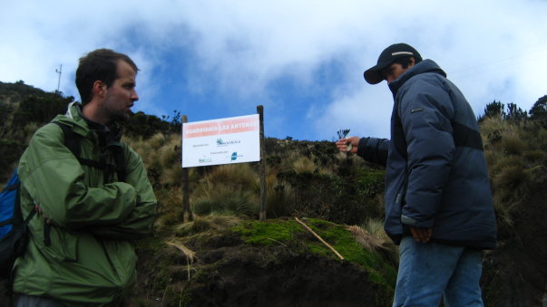
Alex getting directions from the guard at the ranger station. They were something like, “walk to the fourth stick with a bear on it and turn left. It will seem like there’s no trail and then you will come to a wooden bridge and then the trail will start again. Be careful, it’s really cloudy.” Super clear and specific!
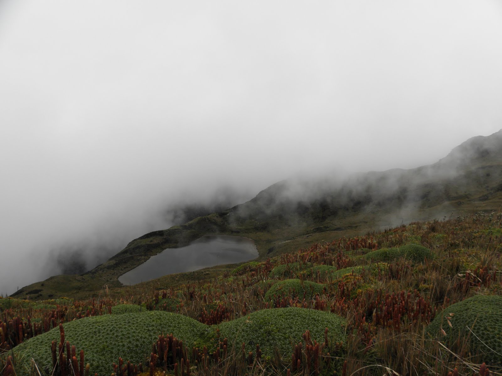
It often rains along this trail and it gets very muddy. We were lucky not to have any rain even though the clouds made it nearly impossible to see anything!
After we reached the top of the first peak and began to walk along it, the clouds started to lift and we got much better views of the crazy high altitude plants.
This may be the point at which we realized we had lost the trail. Alex and Jesse both headed to different peaks to see if they could see where we were supposed to be and there was much discussion of turning back. Can you tell how happy I am about the situation we were in?

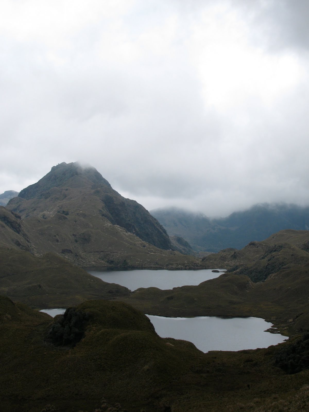
Luckily the weather cleared up enough that we were able to see these lakes. We had a tiny crappy map that basically only showed lakes on it. We were able to figure out roughly where we were supposed to be based on the fact that we seemed to be on the wrong side of the lakes. Jesse also spotted the trail across all those lakes. We knew where we needed to be, now it was just a matter of getting there.
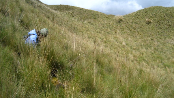
It is extremely hard to walk in giant brush when there is no trail. We were sort of following deer paths and I now have a newfound respect for their ability to walk through this crap. This is just one of the many times I fell.
My mittens were a lifesaver not only because it was cold, but also because it made it easier to grip onto the tall grasses to keep from falling without cutting my hands!

And then we had to jump across a river. This seemed entirely worth it since we were so close to being back on the trail at this point. The other option would have been to walk for who knows how long to get around the lake we had just walked along the edge of….and by edge I mean swampy area surrounding the lake.

Do we look exhausted?
The mountain in the background is where we first were when we realized where the trail actually was!
At this point we are only a few feet from being back on the trail!

Back on the trail!
Besides Jenna and Jesse we dragged our friends Amanda and Diana on the trip too. They were excellent sports about getting lost and amazingly, even after this experience Amanda has agreed to hike the Incan trail with us this summer!

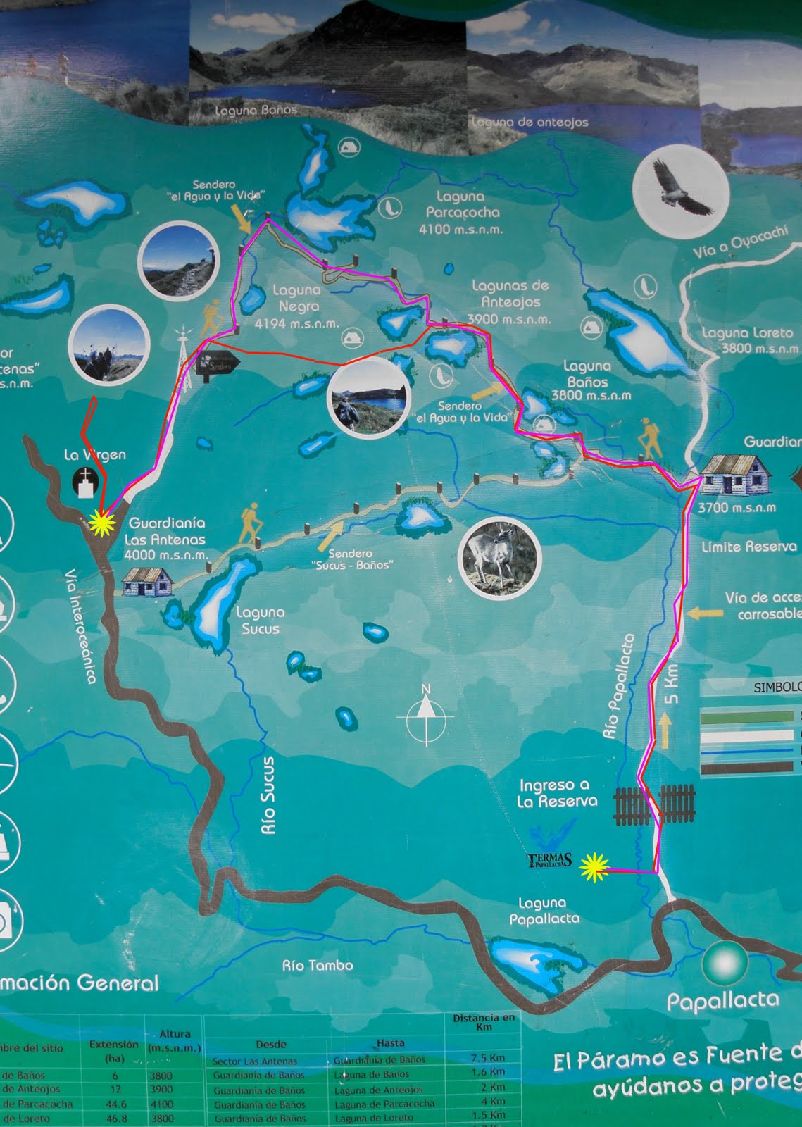
When we got to the second ranger station there was this handy map (would have been nice at the first one!) The pink line is where the trail goes, the red line is where we actually walked. I guess technically we took a short cut, but considering there were mountains, cliffs, and lakes in the way, it didn’t really take us less time. Once we got to the second ranger station we had the guard call us a truck to drive us the rest of the way. It was only about 5km further, but at that point we were all exhausted and had been walking for over 7 hours (at least 2 of which were bush-whacking our own way).
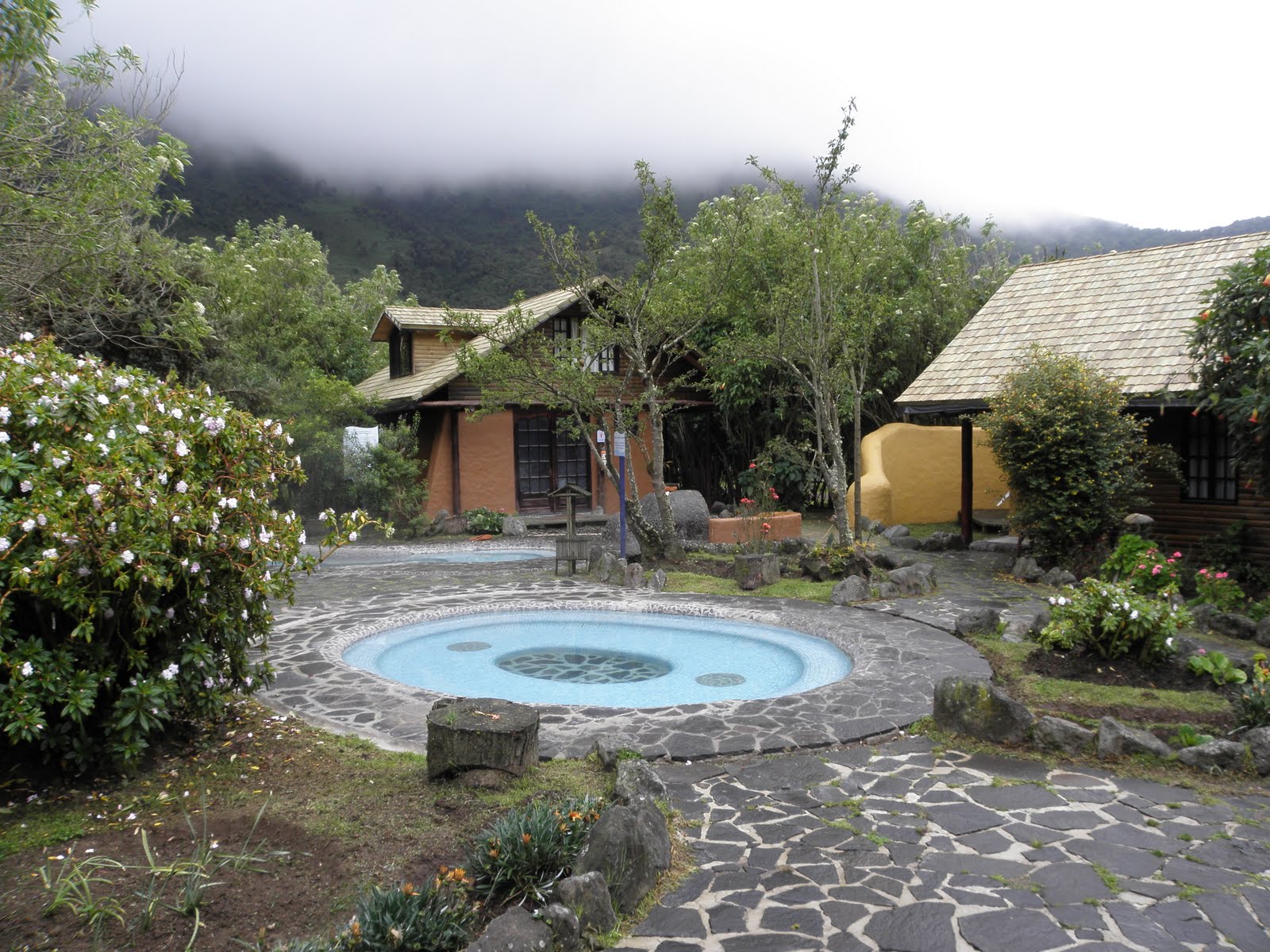
It was all worth it though when we got to the hot springs! There are natural thermal waters that come down out of the mountains. We rented a two story cabin that slept six with a fireplace and a jacuzzi in it. This is the view from the front door. We pretty much spent all of Sunday until check out time at 1pm sitting in that pool.
Here’s the view of our cabin from across the pool with Amanda and Jenna all packed up and ready to go catch the bus home.

The hike was killer, but we all couldn’t help but feel proud that we accomplished what we did. I loved Papallacta and we will definitely be returning often when guests come to visit!

I think you forgot to mention the 20+ mph winds that were hitting us as we were trying to cross the mountain paths!
LikeLike